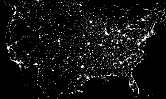
Explanation: This is what the United States of America looks like at night! Can you find your favorite US city on this image? Surprisingly, city lights make this task quite possible. The above picture is actually a composite of over 200 images made by satellites orbiting the Earth. Scans were made by the USAF Defense Meteorological Satellite Program (DMSP) Operational Linescan System. The DMSP satellites continue to help in the understanding and prediction of weather phenomena as well as provide key information about population patterns, city light levels, and even rural forest fires.
1999 2000 2001 2002 2003 2004 2005 2006 2007 2008 2009 2010 2011 2012 2013 2014 2015 2016 2017 2018 2019 2020 2021 2022 2023 2024 2025 2026 |
Yanvar' Fevral' Mart Aprel' Mai Iyun' Iyul' Avgust Sentyabr' Oktyabr' Noyabr' Dekabr' |
NASA Web Site Statements, Warnings, and Disclaimers
NASA Official: Jay Norris. Specific rights apply.
A service of: LHEA at NASA / GSFC
& Michigan Tech. U.
|
Publikacii s klyuchevymi slovami:
united states - Zemlya - issledovanie Zemli iz kosmosa - ISZ
Publikacii so slovami: united states - Zemlya - issledovanie Zemli iz kosmosa - ISZ | |
Sm. takzhe:
Vse publikacii na tu zhe temu >> | |
