Credit & Copyright: NASA,
JPL Magellan Project
Explanation:
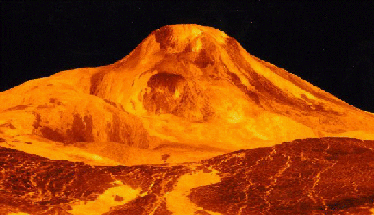
This computer generated view of a Venusian volcano was created using data
from NASA's Magellan spacecraft.
Magellan used its onboard radar to
map the surface of Venus which is hidden
from telescopic observations
by a perpetual cloud cover. Using this radar data to provide three
dimensional information, a computer was then able to produce this
view of Maat Mons, a 5 mile high volcano, from a dramatic
perspective. The colors used to render the surface are based on earlier
color images transmitted by TV cameras on the
Soviet Venera 13 and 14 Venus landers.
1999 2000 2001 2002 2003 2004 2005 2006 2007 2008 2009 2010 2011 2012 2013 2014 2015 2016 2017 2018 2019 2020 2021 2022 2023 2024 2025 2026 |
Yanvar' Fevral' Mart Aprel' Mai Iyun' Iyul' Avgust Sentyabr' Oktyabr' Noyabr' Dekabr' |
NASA Web Site Statements, Warnings, and Disclaimers
NASA Official: Jay Norris. Specific rights apply.
A service of: LHEA at NASA / GSFC
& Michigan Tech. U.
|
Publikacii s klyuchevymi slovami:
Venera - radar - atmosfera Venery
Publikacii so slovami: Venera - radar - atmosfera Venery | |
Sm. takzhe:
Vse publikacii na tu zhe temu >> | |
