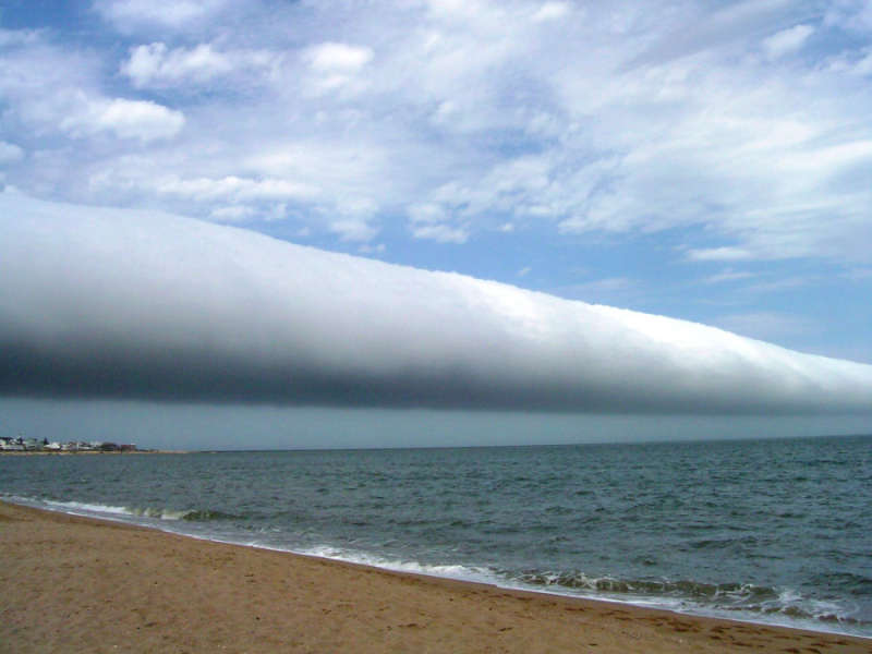
Credit & Copyright: Daniela Mirner Eberl
Explanation:
What kind of cloud is this?
A roll cloud.
These rare long clouds may form near advancing cold fronts.
In particular, a downdraft from an advancing storm front can cause moist warm air
to rise, cool below its dew point, and so form
a cloud.
When this happens uniformly along an extended front, a
roll cloud may form.
Roll clouds
may actually have air circulating along the long horizontal axis of the cloud.
A roll cloud is not thought to be able to morph into a
tornado.
Unlike a similar
shelf cloud,
a roll cloud, a type of
Arcus cloud,
is completely detached from their parent
cumulonimbus cloud.
Pictured
above, a
roll cloud extends far into the distance in 2009 January
above Las Olas Beach in
Maldonado,
Uruguay.
Note: An
APOD editor will review astronomy images of 2009,
hosted by the Amateur Astronomers Association of New York on Friday,
January 8 at the American Museum of Natural History, NYC.
1999 2000 2001 2002 2003 2004 2005 2006 2007 2008 2009 2010 2011 2012 2013 2014 2015 2016 2017 2018 2019 2020 2021 2022 2023 2024 2025 |
Yanvar' Fevral' Mart Aprel' Mai Iyun' Iyul' Avgust Sentyabr' Oktyabr' Noyabr' Dekabr' |
NASA Web Site Statements, Warnings, and Disclaimers
NASA Official: Jay Norris. Specific rights apply.
A service of: LHEA at NASA / GSFC
& Michigan Tech. U.
|
Publikacii s klyuchevymi slovami:
Roll cloud - weather - oblaka - meteorologiya
Publikacii so slovami: Roll cloud - weather - oblaka - meteorologiya | |
Sm. takzhe:
Vse publikacii na tu zhe temu >> | |
